Category Archives: History

Railway Map

June 5 2017

We have found a 1973 Victorian Railways map showing various stations in the network at a time it was considered at its peak.

The marked distance between Deniliquin station and Spencer Street (now known as Southern Cross) is 306 kilometres.

Between Deniliquin and Echuca were the stations of Mathoura, Moira and Moama.

The line between Echuca and Deniliquin was split off between Moama and Moira and created a line that went all the way up to Balranald with stops in places like Caldwell and Wakool.

There is also a line to a place called Warragoon but it is not the Warragoon near Deniliquin, this Warragoon is 83km east of that place.

Deniliquin lost its rail service in January 1979 whilst Balranald lost their service in 1975 and many services in country Victoria were shut down by the mid 1990’s with some services brought back in recent times.

EDIT: Information on Warragoon line added, scanned map expanded to include Warragoon.

Warragoon3.jpg


The 1916 postcard

On December 22nd 1916 a postcard was written with the aim of it being sent to a place named ‘Carrigan Villa’ on the corner of Edward and George Street.

Edward must be Edwardes and that would put the place next to the Baptist Church.

EG

The would of been recipient of the postcard was Connie and the writer was a Jean Williamson who wishes Connie a Happy Xmas and a prosperous new year as well as talking about an Albert who was on the Salisbury Plains and was going to France and Jean will send a longer letter next time.

SCAN0090

The postcard was brought online for the picture of the bridge on the other side of the postcard as most postcards offered online are blank but this postcard has left us with questions

Who was Connie?
What was Carrigan Villa?
Did Albert come back from France?
Did Connie get a letter instead?
Is any of Connie’s relatives still in Deniliquin?

Does anyone have the answers to any of the above questions?

The reason why it wasn’t sent seems to be clear, there was no place to put the stamp without covering up the address plus the writing was overlapping but almost 101 years since this postcard was written it still has our attention and that is the power of history and curiosity.

EDIT: It is considered that what looked like a B is a C so what was considered to be Bonnie is Connie and Barrigan Villa is Carrigan Villa.

Old Train tickets found

Collectors of local historical items from town have found two train tickets from the days where you could take a train ride into Victoria.

The two tickets are ones from Deniliquin to Castlemaine and Deniliquin to Echuca and both tickets are no wider than a ticket you would get from an arcade machine.

Locals have been pushing for the re-establishment of the train line to enable users to once again to into Victoria and the vision of past tickets may make people more eager for such a service to resume in the future.

The development of an Air Freight Hub appears to be the focus of Edward River Council though several locals think that is either pie in the sky stuff or is won’t take off like the Ethanol Plant that was planned for the town in the past.

Train Ticket.jpg

SCAN0087.JPG

Exploring Deniliquin in 2008

April 25 2017

Some people say Deniliquin does not change and that you can go away for a while and come back and everything is the same.

The other week we wrote about Google Earth being behind the times and it occurred to us that we should expand our report and go through the streets and see what existed in 2008 and doesn’t now.

The below pictures are all taken off Google Earth of some of the businesses that are either now gone or moved.

Google

Go-Lo was still going in 2008 but in 2009 the parent company collapsed, was saved by Retail Adventures and then Retail Adventures collapsed in 2012.

Bank.png

The Commonwealth Bank was in Cressy Street in 2008 and moved in recent years to Napier Street.

Furniture

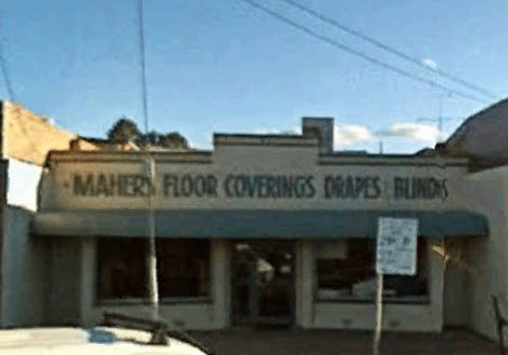
If you needed some furniture, Deni Furniture Centre was the place to go.

KFC
KFC was still going and at this time was getting the bucket fixed, it closed in 2010.

R&J's

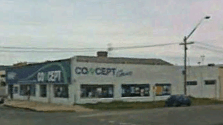
R&J’s – A great place to go to when you needed entertainment like CD’s and more.

Retravisio

Retravision was a big company across Australia until the late 2000’s and was gone by 2012 as the group of companies either split off from the Retravision group to survive or financially collapsed.

shed

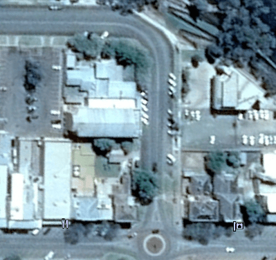
This building is a reminder of the death throes of the rail line as it no longer stands.

SP

Subway’s first store in town and Pinky’s Pizza, luckily for Deni another Subway opened up and Pinky’s Pizza is now occupied by That Pizza.

SW

Silly Willy’s before they moved out and Harvey Norman expanded to take its place.

Mits2

Mitsubishi signage was still up in 2008.

2008.png

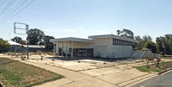
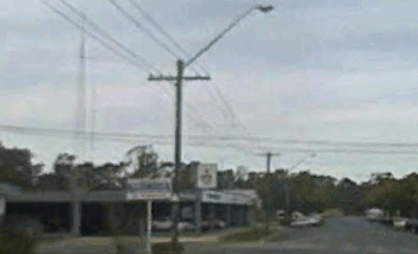
The former Shell petrol station before its demolition, only the empty signage pole and holder remained by 2010.

Edward Theatre.png

The Edward Theatre still lives on Google Earth but not for long as other views take you to 2010 and 2017.

News.png

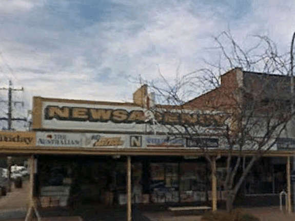
The Newsagency before it moved to Cressy Street.

Real Estate.png

One of the quirks of Google Earth is you can go on Street View and going around the roundabout you can see this building go from occupied to empty as time changes eight months in one mouse movement.

Party.png

Deniliquin Party Hire is another business that has moved between 2008 and today, go around the other side of the business on Google Street View and you can see inside as the roller door is open.

Metro.png

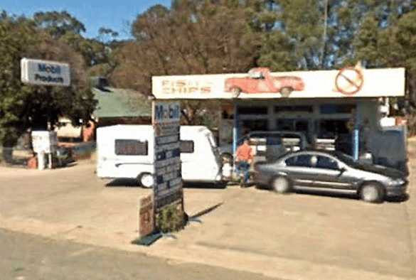
Now a Metro station, it was Mobil back in 2008.

Mahers.png

Concept1.png

Big River.png

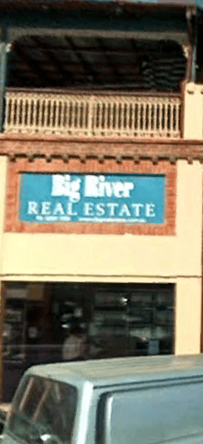
Big River Real Estate was in Napier Street in 2008 and is now in Cressy Street, it is one of few businesses you can see in the 2017 photographed sections of Hardinge and Cressy Street therefore making it appear twice if you go on a street view tour of town.

As you can see lots has changed since 2008 and the above is just a small sample of the shop changes, unfortunately the lack of high resolution images have hampered efforts to display great images for posterity but we hope you enjoyed our search on Google Street View to present this history presentation.